

Talk of data transit through Kazakhstan almost always runs in terms of capacity and routes. On the build it looks different: a route is soil category, the number of water barriers, and the number of railway crossings. Below — what a backbone timeline is actually made of, using our sections as the example.
Why kilometrage alone cannot set the timeline
Route length sets the volume of work, but it does not say at what pace that work can be done. Two routes of the same length can take different time: one has light soil and easy access, the other heavy sections, rivers, railways, and long equipment moves.
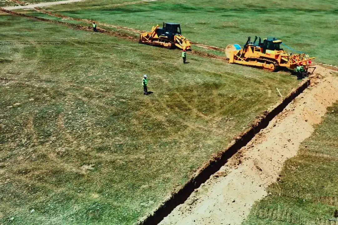
The reason is that a backbone is built by two fundamentally different methods at once. The main length is closed by a mechanized column moving continuously through the ground. Everything the column cannot pass — rivers, railways, operating highways, forest stands — is closed by point crossings, and each crossing is a separate operation with its own mobilization.
So the question “how many kilometres” immediately brings four more: what soil is on each section, how many crossings there are, how the equipment will reach the route, and in what conditions the crews will work.
Soil category and column pace
Soil category determines which column goes out on the route and at what pace. Under our production program, that is 10 to 40 km a day:
| Column | Soil category | Pace per day | Pace per month |
|---|---|---|---|
| Light column | 1–2 | up to 30 km | up to 600 km |
| Coupled heavy columns | 3–4 | up to 40 km | up to 900 km |
| Heavy column | 5 | up to 10 km | up to 200 km |
| All five columns | — | — | up to 1,700 km |
The figures in each row are the pace of one working unit on the route, not of the whole fleet. A light column works on its own. In category 3–4 soils heavy columns run coupled, and up to 40 km a day is their combined pace, not the pace of each column. Heavy columns work regardless of weather. The monthly figures of the three column types add up to 1,700 km: the capacity of all five columns working at once on different sections.
Practical takeaway for the client: a daily-pace figure cannot be transferred from one project to another without checking the soil category along the route.
Crossings: where the schedule actually loses days
Crossings are where a backbone stops being linear work. Every intersection with a river, a railway, or an operating highway is closed by drilling, not by laying.
We use two methods. Horizontal directional drilling (HDD) goes under rivers, railways, and forest stands — where the surface cannot be opened. Pipe jacking closes shorter crossings: sidewalks, the roadway.
One crossing under a major river can take longer than several kilometres of laying in light soil. That is why the schedule counts crossings separately from kilometres.
942 km in five months: how it was distributed
From August to December 2025 we laid 942 km of backbone FOCL in the ground on two directions: 577 km on the western (five sections) and 365 km on the southern.
That is an average pace of about 190 km per month across the project as a whole — noticeably below the calculated capacity of the columns. The gap between calculation and fact is the content of the work: moving equipment between the eight sections of the two directions, crossings, approvals, acceptance. The calculated 1,700 km per month is the fleet’s power ceiling, not a timeline promise.
The full cycle behind these figures: route survey, design, mobilization, marking, earthworks, HDD and pipe-jacking crossings, laying, splicing and measurements, as-built documentation, handover. Skipping any stage moves the problem to acceptance.
What this means for a transit route
A transit corridor through Kazakhstan is first of all a question of a physical line in the ground, not a question of equipment at the ends. Optical fiber on the Asia–Europe route passes through the same soils, the same water barriers, and the same railway crossings as any domestic backbone.
Our western and southern directions are sections of the same task: a continuous line at a depth of 120 cm, with crossings where the surface cannot be opened. Route geography changes the length and the number of barriers, but it does not change the method, or what sets the timeline.
If you have a route and need a realistic schedule — from our side the conversation does not start with kilometres alone: soil category by section, the number of crossings, equipment logistics, and site conditions. That is what the timeline is calculated from.